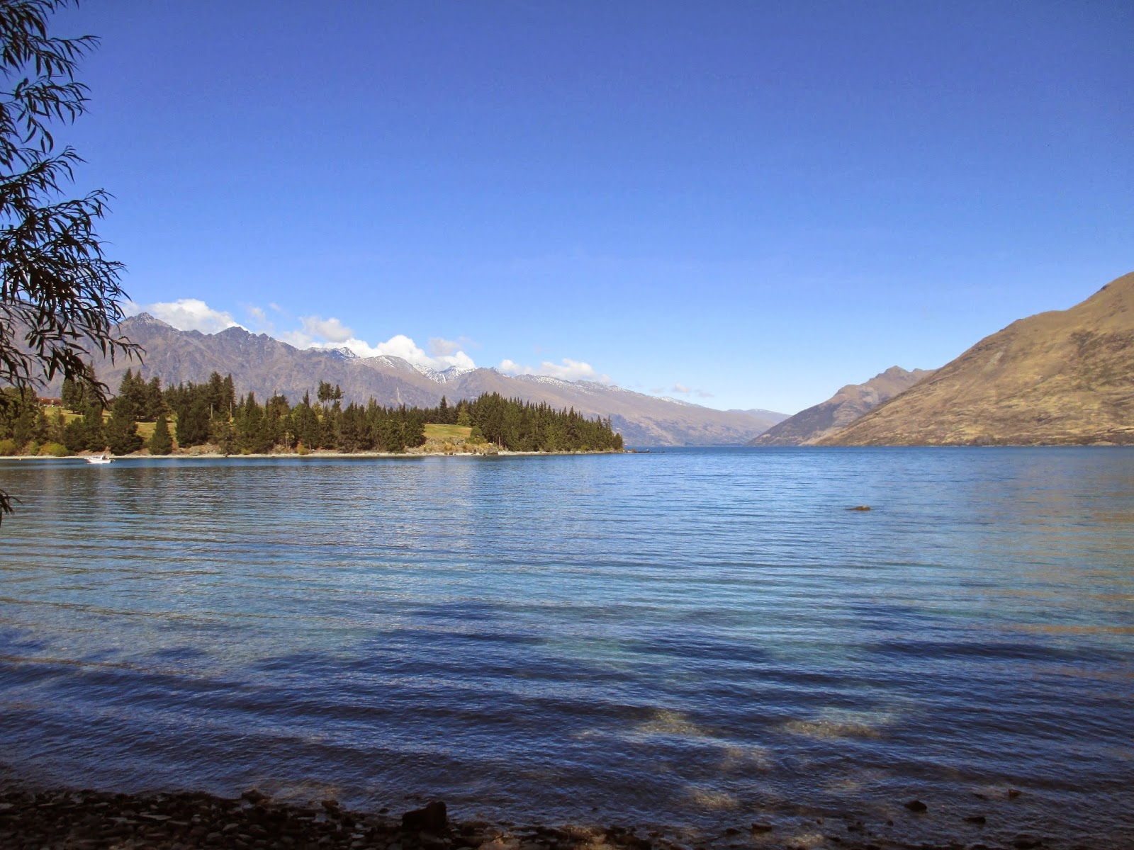
Tuesday, 1 April 2014

The Wild West


Our journey through the South Island had already taken us to the West Coast, but much further North. This time we were approaching from the South. The 150 mile drive along State Highway 6 was spectacular, taking us past Lake Hawea and then Wanaka and over the Haast Pass. The journey took us through an ever changing landscape of high mountains, rain forest, wetlands, lakes, glacier-fed rivers and white water rapids. We stopped for a coffee at Makaroa and then detoured for a walk to the Blue Pools. A track took us over the River Makaroa by way of a swing bridge and through native bush until we arrived at another swing bridge above a gorge opening. Below were bright blue, glacier fed pools of water that were crystal clear. We could see large brown trout in the water and by the river bed people had erected hundreds of tiny cairns. 


The Blue Pools, Makaroa

A few miles further on we stopped again to see a spectacular waterfall and at the Haast Pass we pulled off the road to look at the torrent of white water plunging down rapids in the Haast River. This was to set the pattern for our journey. 

Thunder Creek Falls
The raging white water of the Haast River.


As we drove further west there were fewer and fewer signs of human influence. The rain forest appeared impenetrable and underlined the West Coast's reputation for being an inhospitable environment. This area, along with Fjordland is the wettest part of New Zealand and very few people live here. Although it wasn't raining during our journey dense cloud hung over the forest, mists rose on the mountains above us creating an oppressive atmosphere. Eventually we arrived at Fox Glacier Village and checked into a campsite. The glaciers on the West Coast are very unusual in that they end in temperate rain forest - an environment that can only be seen in parts of South America and New Zealand. I was keen to see Fox Glacier so later that afternoon we made the most of the dry weather and went to see how close we could get to the glacier face. The Department of Conservation closely monitor the glaciers because there are daily ice and rock falls. They are dangerous places and we heeded the warning signs that advised visitors to keep to a marked track. In 2009 two tourists who had strayed from the path were killed by ice fall. A 45 minute walk brought us reasonably close to the glacier face. It was - as most glaciers are - quite grubby! 

The approach to Fox Glacier

Fox Glacier up close. There are guides in the bottom right of the photo to give a sense of scale
The next day heavy rain was forecast but fortunately it started off overcast but dry. We made for Lake Mathieson, famous for its views of Mount Cook and Mount Tasman. The former peak was hidden in cloud but Mount Tasman was just visible although rather strange cloud formations were wrapping themselves around its summit.


We completed a full circuit of Lake Mathieson and our effort was rewarded; although Mount Cook remained hidden from view, we did get the famed reflections of the mountains in the still waters.


Views of Mount Tasman reflected in Lake Mathieson
By the time we reached Franz Joseph to walk to the glacier of the same name the rain had set in. Despite this we walked as far as we could get, got thoroughly soaked but saw the glacier face. 

Mrs B. advising me to go no further...

Two wet walking Bootes...
 Mrs B. suggested we try a trip to the coast as she thought the weather might be better there..and I set off for Gillespie's Beach taking a twisting and turning gravel road for miles and miles until we arrived. It probably wasn't quite what Mrs B. had in mind (golden sand and sunshine)...as we found a windswept, desolate expanse of pebbles. Someone had been creative in the past as we spotted a pebble that had been decorated and left on the beach - which made for a lovely touch.


Gillespies Beach, West Coast, South Island.

Next day the rain had stopped and we continued to head northwards up the west coast. Early morning mist rose like smoke from the swollen rivers and hung above the tops of the forest trees. 

 
Early morning mist rising over the swollen Waiho River

Homes, farms or any sign of human habitation were few and far between until we arrived at a bizarre museum/gift-shop/cafe called 'The Bushmans Centre'. Their signature dish is Possum Pie..and they are currently in dispute with the NZ government as they can't use the possums they hunt and kill themselves to make the pies. Possums are considered a pest in New Zealand, there are 70 million of them so hunting them is actively encouraged...putting them into pies isn't. We settled on a cup of tea and fruit scone...somehow it seemed a safer food choice.


We finally arrived at the small coastal town of Hokitika, the centre of pounami carving. Pounami or greenstone, a form of jade, was and still is much prized by the Maoris and carved or shaped into weapons, ceremonial necklaces and other ornaments. Hokitika was also the setting for the recent Man Booker winning novel 'The Luminaries' set in the gold rush era of the 1860s, and the town retains a fair number of heritage buildings making it possible to imagine what life must have been like 150 years ago. We relaxed here, purchased some pounami necklaces as gifts and walked along a sunny but breezy beach.


Having found a quiet campsite on the edge of town (complete with highland cattle, goats and an alpaca) we watched the sun set into the west on the beach. Once it was fully dark we walked a few hundred meters to see some glowworms in a little dell just across the road from our campsite.

Sunset...
....and glowworms
It was now time to say goodbye to the West Coast for the last time. We were headed back east towards Christchurch and the end of our travels..but still had time to squeeze in a few more adventures before handing back Ned.


Friday, 28 March 2014

A Puzzling Time in Wanaka

The town of Wanaka sits on the shore of Lake Wanaka and is surrounded by mountains making for a peaceful and relaxing setting. Not as lively as Queenstown Wanaka still offers a good few amenities including restaurants,  bars and shops. It also provides easy access to lakes and mountains being the gateway to the Mount Aspiring National Park. Our drive took us over the Crown Range via a series of hair pin bends until we passed the much photographed Cardrona Hotel. I added a few more photos to the memory card!


We arrived mid morning and sat outside a bakery in warm sunshine with a coffee and doughnut...an essential dietary choice when contemplating a walk! Suitably refreshed we wandered around town and then out along the shoreline towards the west returning by the same route after a mile or so.


We  then chose a campsite on the edge of town, (an old style Kiwi campsite) with lake views and only 10 minutes walk into town and after lunch headed off to explore the other shoreline and do another walk. I'd read about Diamond Lake, a small mirror surfaced lake up in the hills and found the signs and a parking area. It was a warm afternoon so the climb uphill involved a bit of effort but the lake was as still and beautiful as described.  We walked around the lake surrounded by birdsong, stopping to take photos before taking the route back downhill. 

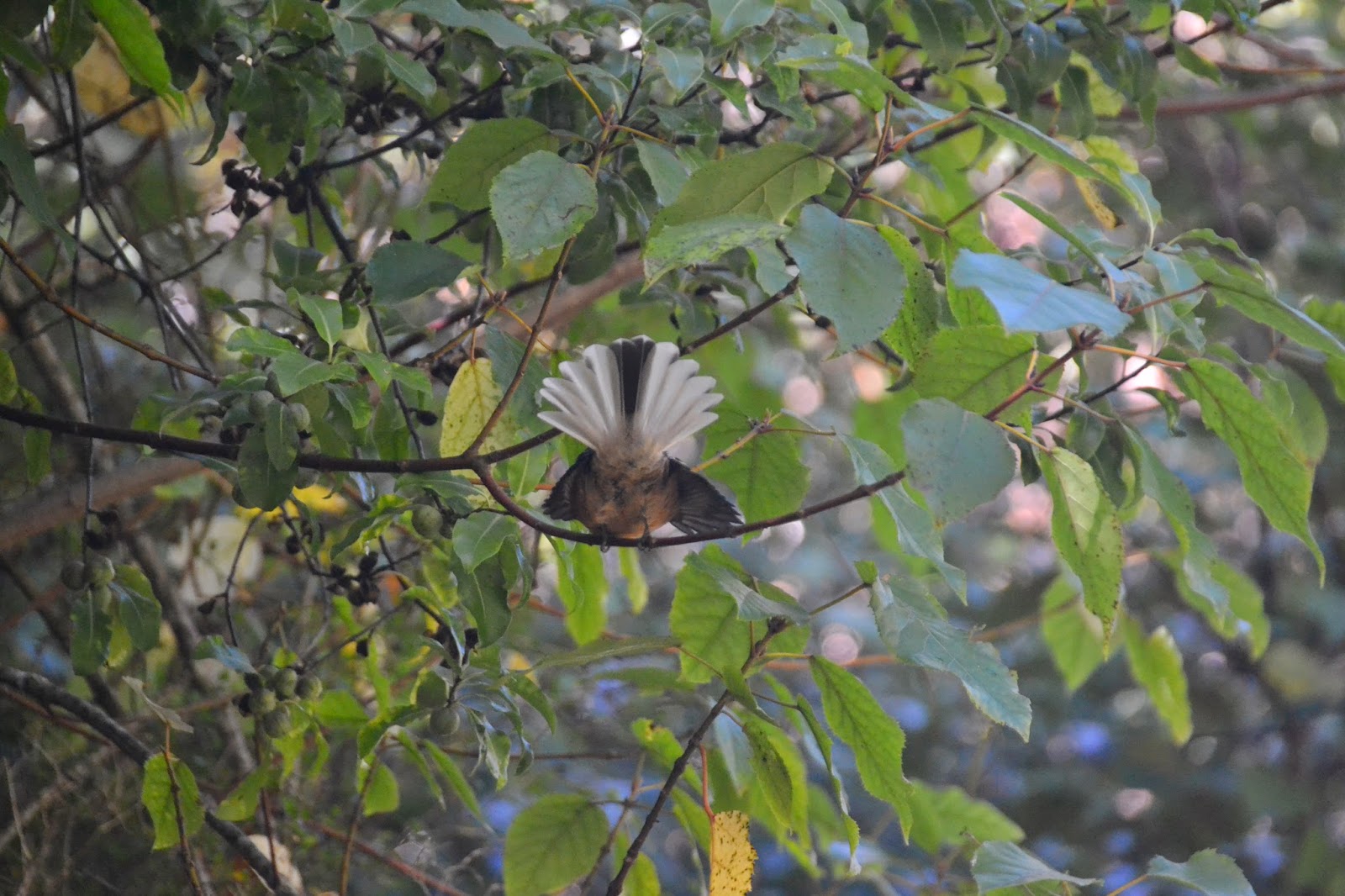
A fantail displaying for us at Diamond Lake

Diamond Lake
The next day was Mrs B's birthday...so I took her to a maze..and reassured her I wasn't trying to lose her. Just on the edge of Wanaka is a long standing attraction called Puzzle World. It has a giant, multi level maze. Once you enter the challenge is to find all four corners and then return to the exit. This is harder than it sounds as in order to get from one part of the maze to another you have to climb a level, use upper walkways and footbridges all of which are riddled with intricate one way systems. There are dead ends and even the corner towers can be tricky to find. We raced around at the start and successfully found all four corners in 20 minutes so felt pretty chuffed. Finding the exit however was a bit more challenging...and took another hour. Mrs B. found the exit...I think it was her unerring sense of where the gift shop was located that helped! After a break we went into the illusion rooms..stuffed full of amazing visual trickery, holograms and puzzles. Everything was done with a good dash of fun and we both went around with smiles on our faces.


Part of the amazing maze.

Mrs B. after her breakfast porridge


After lunch we walked the eastern shore of Lake Wanaka..about a 4 mile round trip and then made our way to the best cinema in the world. Cinema Paradiso is a fantastic independent cinema. Film goers are able to order meals for the intermission (all films have one) and we placed our orders and took our seat..which happened to be inside an old car. There were lots of comfy seats..including sofas. We watched '12 Years A Slave'..enjoyed the freshly cooked food at the intermission and their home made ice cream. You can take a glass of wine or a beer in too..Cinema Paradiso is just perfect. (the film was pretty good too..)
Cinema Paradiso seat...not a drive in movie!

Wanaka had been a good place for a few birthday treats but our time in New Zealand was passing quickly now so it was time to move on again. We were headed for the wild West Coast and hoped to get close to a glacier or two.

Thursday, 27 March 2014

Searching For Gold

Arrowtown is a quiet settlement today, picture postcard pretty and a magnet for visitors because of its well preserved colonial era buildings. It was to be our base for a couple of days as we explored Arrowtown itself and the surrounding area. In 1860 Arrowtown looked very different and there probably wasnt too much to see..but the discovery of gold in the Arrow river changed all that. A gold rush started and 4000 hopeful immigrants, from Europe and China flocked to the area in search of a fortune. Today Arrowtown is somewhat gentrified but the buildings reflect its history and it looks more in keeping with the Wild West of the United States rather than New Zealand. We even spotted horses tied to a hitching post outside the pub to complete the illusion.


We wandered around the conserved remains of the Chinese settlement, and learnt much about the history of the goldrush era in the small but interesting museum. The Chinese immigrants were welcomed at first, then subjected to appalling bigotry and prejudice before finally being accepted into the community. Arrowtown also had a small selection of shops including a bakery. Mrs B. was tempted by their apple strudel.
Mrs B. caught in the act...
On our second day we went down to the river (no gold found) and climbed for an hour up the Tobin Track through trees until views opened up across to Lake Wakatipu and the Gibbston Valley. As if to greet our arrival at the top a rainbow appeared - despite no rain - and just added to the scenic views.


As some showers were forecast for later we headed off in Ned to explore the Gibbston Valley, the town of Cromwell and the wineries near Bannockburn. We drove through the Karawau Gorge but didn't stop..saving this for the return journey. By the time we got to Cromwell the heavens had opened and we took refuge in the town centre. Cromwell wasn't very inspiring (but did have giant fruit!)...


About the only interesting thing in new Cromwell!

...but of more interest about a mile away was Cromwell Old Town a collection of heritage buildings that were taken down when the old town was flooded in the 1980s as part of a hydroelectric project. They have now been lovingly conserved, restored and resurrected on a site adjacent to their original location.


One of the conserved buildings of Old Cromwell
After the showers subsided and we'd explored the Old Town we headed off to Bannockburn. The wineries around this small settlement are reputed to now produce some of the world's finest pinot noirs. The landscape is dry and desert like but supports pockets of vineyards which suit the pinot noir grape. It was again noticeable how the geography of New Zealand could change so dramatically within a few miles. I visited the Mount Difficulty cellar door and purchased a bottle of Roaring Meg...for consumption at a later date.

A satisfied customer at the Mount Difficulty vineyard

On our return journey we stopped at various places in the Karawau Gorge. The fast flowing blue waters cut through narrow channels were good to watch from a distance..as were the bungy jumpers leaping off the old Karawau Bridge. I offered to buy Mrs B. a ticket so she could have a go..but she declined my generous offer...can't think why!

The Karawau Gorge
The old Karawau Bridge...for some reason Mrs B. didn't want to jump.... 

The next morning we headed north as our next destination was to be Wanaka which was to prove scenic and puzzling in equal measure.

Sunday, 23 March 2014

Queenstown Thrills

Queenstown is the adventure and adrenaline fuelled centre of New Zealand...and was to be our next destination. If bungy jumping, canyoning, parascending, sky diving or jet boating are your thing this is the place to come. The town also happens to be in the centre of a beautiful mountain area and sits on the shore of Lake Wakatipu with the backdrop of the Remarkables range of mountains.

Lake Wakatipu and The Remarkables
Our campsite was only 5 minutes walk from the centre of the town. It was compact and quirky..with toilets that had received a unique interior design treatment!


On our first day we walked around the town, along the lake shore and treated ourselves to a Fergburger. Fergburgers are a million miles from MacDonalds in terms of  the freshness of the ingredients,  the range and the taste. People queue at busy times and it wasn't difficult to understand why they are so popular. We also booked a trip for the following morning, which meant an early start.


The jet boat is a New Zealand institution and I'd wanted to try one before we left. There are several jet boat companies operating in Queenstown but the one I'd selected combined two thrills in one outing. The Skippers Canyon jet, like most jet boat companies, offers speed, 360° turns and thrills galore but unlike the other companies includes rather an interesting road trip before you arrive at the jet boat. Mrs B. had bravely decided to join me..but I hadn't told her too much about the approach road...which was probably wise. At 8.30 am a small 4 wheel drive coach picked us up and we set off  on a steep mountain road. Then we left tarmac and started a 13 mile trip along a narrow, unsealed, twisting road with sheer drops. A few days later whilst drinking coffee and browsing the local newspaper we came across this article:


Its a good job Mrs B. hadnt seen this earlier. As it was the drive was spectacular. We saw the rocks that had been used as the Gates of  Mordor in the Lord of the Rings films (plus a bit of CGI) and every turn in the road brought a fresh view of our exposed situation. We passed a part of the road that had collapsed a few months earlier..necessitating cutting through fresh rock to open up a new route.

Part of the Skippers Canyon Rd...

Eventually we arrived in Skippers Canyon itself, donned lifebelts and waterproof capes and set off at breakneck speeds down the canyon passing inches from the rock walls. It was tremendous fun..we hurtled around bends and saw another LOTR location (the ford of Bruien) before heading back along the canyon at 60mph. Mrs B seemed to enjoy herself...but was shrieking at regular intervals.


Mrs B....making a lot of noise!

I returned happy..but slightly deaf in one ear!

Later that day we went up the Skyline Gondola which took us 450 meters up above Queenstown and dined in the Skyline restaurant with panoramic views from our window table. After far too much food we wandered around at the top of the hill and walked through a forest getting views of Ben Lomond. We then returned to find keas investigating the chair lift apparatus. Their natural curiosity served as a good diversion whilst we waited for sunset. Watching the sun go down over the Remarkables made for a peaceful end to a day that had started with plenty of thrills.


Whilst there had been a buzz to Queenstown, which was enjoyable for a short time, we were both keen to leave after a couple of days to experience somewhere a little more restful. We decided to decamp and explore the beautiful landscape in the surrounding area. Heading to the Dart River and the settlement of Glenorchy we set off on gravel back roads to find Lake Sylvan...and eventually found a place to start a walk. Crossing a swing bridge led to regenerating New Zealand beech forest, along an old logging tramway. Moss covered rocks, birdsong and a green light filtered through the tree canopy made for an almost otherworldly atmosphere and a sense of isolation. We found Lake Sylvan itself surrounded by trees and beyond high mountains.


Lake Sylvan
After a few more diversions we headed to a Department of Conservation campsite at Moke Lake about 8 miles up in the hills. This peaceful and somewhat remote location was used in the BBC drama 'Top of the Lake'  screened last year. It was a lovely place to camp and the on site warden was really friendly.
Peaceful Moke Lake
Unfortunately I had an increasingly dodgy travellers tummy so we didn't do too much other than feed a few ducks and watch the sun go down over the hills. The following morning Mrs B. left the camper to visit the toilets whilst I stayed dozing in bed. My slumbers were disturbed by a loud clattering and banging noise on the camper and I thought Mrs B. was trying to wake me up in a rather unsubtle manner. I got out of bed, out into a chilly misty morning to find no sign of Mrs B.....but there were 2 keas on the roof of Ned. I tried to entice then down but they seemed determined to wreak havoc..so worried about the camper and not wanting a repair bill I squirted one of them with a water bottle. It worked...it flew down, followed by its mate, hopped around in front of me with a very hurt expression. Then it flew a few meters and started to investigate a fellow campers tent. After a quick breakfast we left the keas to their mischief and made our departure..we were headed to Arrowtown and the promise of gold.

Wednesday, 19 March 2014

The Sound of Silence

A cursory glance at the south west corner of the South Island reveals that Fjordland is a true wilderness area. There are few roads and even fewer people living here. Its an inhospitable landscape covered by dense rain forest that cloaks mountains that fall almost vertically to the Tasman Sea in a myriad of inlets and large steep sided fjords.  We travelled to a small settlement of Manapouri, situated by a lake of the same name in order to get a little closer to this wild and remote area.

Early morning we set off as the sun was rising on the first stage of a journey that would take us to Doubtful Sound, one of the few fjords accessible to travellers. This first leg of the journey involved taking a boat across Lake Manapouri..a beautiful lake in its own right.


Early morning on Lake Manapouri

At the western arm is a small jetty and a coach was waiting for us to take us up and over the Wilmot Pass. This road is remarkable. It is reckoned to be the most expensive road built in New Zealand and its only accessible by boat either from Lake Manapouri or Doubtful Sound. Built to facilitate the construction of a hydro electric power station (buried deep underground) and 13 miles long, it took 2 years to complete and rises to 670 meters. Our trip included a brief visit to the Manapouri power station down 2 kilometers of tunnel, to something of an engineering masterpiece. Using 7 giant turbines this hydro electric plant produces around 10% of the South Islands electricity..and powers an aluminium smelting plant at Bluff. But for the outflow on Lake Manapouri you would have no idea it existed.
Deep underground..the Manapouri Power Station

The drive over the Wilmot Pass opened up a vista of Doubtful Sound far below and our coach negoiated the steep twisting descent to deposit us by another small jetty for our next boat trip.


First view of Doubtful Sound from the Wilmot Pass

The next 3 hours involved a cruise up Doubtful Sound out to the Tasman Sea. It was an overcast day and this made for a dramatic journey passing silent rain forest cloaked valleys that appeared to resemble lost worlds. Waterfalls and cascades plunged from great heights. 


The magnificent Doubtful Sound


We passed close to an 800 meter high cascade that appeared to drop almost vertically. One of the most striking qualities was the silence.  Sadly there is little bird life in these vast forests. Early European settlers introduced stoats and weasels to try and control the rabbit population (that they brought to New Zealand in the first place) and these efficient predators largely wiped out the native birdlife. Efforts are now being made to eliminate these predators and slowly some native birds are returning to the forests. Doubtful Sound isn't without life though. We saw yellow eyed penguins fishtailing through the water - a rare behaviour - and little blue penguins diving for fish. We also saw a large fur seal colony and delighted in watching young seals dive and play off the rocks.

All too soon we arrived back at the jetty for a return journey by coach and then boat. The whole trip lasted 8 hours and was a very special day.

Our next base was Te Anau, a nice lakeside town and we stopped for a couple of nights in order to make a return journey to Milford Sound (a 140 mile round trip). Milford Sound is world famous but the journey there along the Milford Highway is equally spectacular. Lots of unplanned stops and detours were made! On the outward leg we stopped by the 'Mirror Lakes' and drove 15 miles along a bumpy gravel road to do a walk to see the Humboldt Falls.


The 250 meter high Humboldt Falls
Finally we arrived at Milford Sound itself. I expected it to be overrun with coach parties but it seemed quiet...or maybe the scale of the mountains and scenery absorb the masses. It was overcast on arrival but patience was rewarded as, after a picnic lunch and a walk, the cloud cover lifted and Mitre Peak revealed itself. We also saw wonderful views of the Bowen Falls, lots of little silver eye birds by the shoreline and it was hard to tear ourselves away. Returning via the 1.2 kilometer long Homer Tunnel which is single lane but traffic light controlled, we saw more kea waiting by the traffic lights....no doubt planning some mischief. 


Mrs B. ...and Mitre Peak
The Bowen Falls, Milford Sound

We stopped again to walk to see 'The Chasm' a spectacular cascade that pours water with frightening velocity through rock arches and hollows. Finally after another 'grand day out' we arrived tired but happy back in Te Anau and rewarded ourselves with a delicious crepe from a little creperie called La Roulette operating out of a caravan.


Fjordland had been billed as a spectacular place to visit and it hadn't disappointed.