Thursday, 27 February 2014

Whales 4 - Albatross 1 (home win)

The road to Kaikoura from Blenheim crossed the Marlborough plains with acre upon acre of vinyards and signposts to wineries at every turn. It then climbed through rolling grassy hills before finally reaching the coast. State Highway 1 hugs the Pacific coastline for around 50 miles with the rolling breakers crashing against rocky shorelines to one side and forested mountains at the other. Approaching Kaikoura we stopped for a bit more fur seal spotting (still Mrs B's favourite game) and were fortunate to be able to see lots basking on rocks including some pups. I managed to get within 2-3 meters of a group (including a pup) and the camera was in full use for quite some time...


Eventually we reached Kaikoura and checked into our campsite after a picnic lunch and more seal and sea bird watching!


There was a good reason to detour here...it has the reputation of being the best place to go whale watching in New Zealand. It is ringed by mountains (The Seaward Kaikoura range) and this makes it a very scenic location although the mist was down when we arrived covering the mountain tops.  The ocean floor drops steeply to great depths just off the coast providing a wonderful environment for marine life and a perfect feeding ground for adult male sperm whales.

Measuring (on average) 16 meters sperm whales are the largest toothed whale in existence and the largest predator on earth. Their main diet is giant squid but they also hunt and eat smaller sharks. The males feed in the cooler ocean currents off Kaikoura bulking up so they can impress the ladies as it were....I can hear some of you saying typical male behaviour!

My whale watching tour was booked for the following day. It rained overnight and was drizzling in the morning so my hopes of actually seeing anything out at sea were not high. Fortunately by the time I checked in to board the boat the sun was about to come out and it was getting very warm.


The company providing the tour don't guarantee any whale sightings for a good reason. Sperm whales dive to around 300-500 metres (sometimes deeper) and spend up to an hour feeding. They then surface for between 5-10 minutes to take in oxygen and digest their food. Spotting a whale involves some skill, good eye sight and a bit of luck. Our fast powered small boat had a hydrophone to listen for their sounds. I saw 4 sperm whales over the course of 2 hours and to get so close to such magnificent creatures was quite simply wonderful. To see them dive, with their massive tail flukes rising vertically into the air was just breathtaking.  
There he blows....

Dive, dive, dive......

During our trip we'd spotted various species of albatross but not the largest one...the Royal Albatross. With a wingspan of 3 meters and flying/gliding speeds of around 40 mph this bird is another giant of its kind. As we were headed back travelling at a fair speed our guide spotted one off the starboard bow. We picked up speed to try and track it,which we did, with difficultly) for about 5 minutes before it gracefully soared away disappearing into the distance. For the umpteenth time that day my breath had been taken away.

Royal Albatross in flight

I returned to Kaikoura very happy..and celebrated my good fortune in the pub..where it was happy hour. A perfect day ended eating blue cod and chips from a chippie that had been voted the best on the South Island for 2014. Fine dining at its best!

Wednesday, 19 February 2014

Marlborough Country

On an overcast, rather grey morning at the early time of 7.00 am,  after our last night's sleep in Wellington,  we checked in to catch the first ferry across the Cook Straits to continue our travels through New Zealand. Although it doesn't look far on the map the crossing takes 3-4 hours. 

During the first part of the voyage we chatted to a student who was returning to study accountancy in Dunedin after a summer working in retail. It was interesting listening to a young New Zealander share his hopes and aspirations for the future. 

Later in the journey we went out on deck to find bright sunshine. As our ferry navigated its passage through Queen Charlotte Sound our breath was taken away by the stunning views of forest clad fjords, sparkling blue sea and a backdrop of mountains. It was quite simply a magnificent way to arrive.


Our first night would be spent in Picton, gateway to the South. After lunch and checking in at our campsite we tried a short walk to Bob's Bay. This gave lovely views of Queen Charlotte Sound from a footpath we'd spotted from the ferry.  A steep climb back over the hill and equally steep descent brought us out by a 'dairy' where we could get some cold drinks. The 'dairy' is an institution in New Zealand. Most small towns have at least one and they are all little independent convenience stores that sell fresh food, veg, dairy products (obviously) and sundry other items like fish bait.

The next morning we had what I thought would be a short drive to Blenheim, main town in the Marlborough wine region. Now I confess to not looking at the map too closely and decided the coast road would be a more scenic albeit slightly longer drive. What I didn't know was that 25 of the 30 miles would be on gravel..and on steep winding road. There was no rushing this drive..not that there was any need as the views were stunning. We went through lots of little bays, stopping frequently to take photos or just admire the scenery. The whole area was sparsely populated but littered with a few reminders of the 19th century whaling industry. 


Views from various places on the Picton - Blenheim coast road

Eventually we reached the level and tarmaced roads of the Marlborough plains...and acre upon acre of vineyards. Three quarters of all NZ wine comes from the Marlborough region and there are wineries galore. The reason for this is geography. Mountains surround the region protecting the grape vines from the prevailing winds. Fertile soils and a warm dry climate make for ideal growing conditions. For this reason there are also lots of orchards and plenty of places to buy delicious fresh fruit.

After first taking Mrs B to another boutique chocolatier (free tasting and a mandatory purchase) I pointed Ned in the direction of the Clos Henri winery.


Mrs B. about to enter chocolate heaven!
With a deconsecrated wooden church as the cellar door this winery was in a beautiful setting.
 

A happy consumer!

Started by a French family who have vinyards in the Sancerre region, this small wine maker produces some really good white wines. After a tasting Mrs B. treated me to a bottle of one of the Sauvignon Blanc. We were both happy with our respective purchases!


Sadly our time in Marlborough was short but at least we'd been able to sample some of the region's produce and the sun continued to shine unabated as we travelled on to our next destination:Kaikoura.

Tuesday, 18 February 2014

Wellington Bootes!

The rain that had arrived in Martinborough followed us to Wellington but it wasn't going to deter us from sampling a little city life after many days in small towns and rural New Zealand. Wellington has the nickname of the windy city due to the ever present winds that funnel through the Cook Straits and we felt the effect as we strolled along the waterfront from our car park / camper van site to Te Papa. 


Te Papa must be New Zealands best museum. It is located right on the waterfront in a contemporary building and has so much to see that it be easy to spend day after day exploring the wonders it contains. From giant squid to both traditional and contemporary Maori meeting houses (marae) and much more in between it was hard to leave after just half a day. 


Our next destination was Cuba Street. This runs almost down to the harbour front for at least 1km and is full of quirky shops, restaurants and street art. I liked Cuba Street a lot...it had a counter culture vibe and there is a bucket fountain and a laundrette that converts into a restaurant in the evening. We settled on a superb South Indian/Malaysian restaurant for a meal that served a tasty goat curry with dosa. Mrs B.was ambitious and went for a hot chicken redang!


The next morning the rain had disappeared and this was the cue to take the famous Wellington cable car up to the botanic gardens. 


An interesting little museum on the history of the cable car detained us before a slow walk down through the botanic garden towards the parliament building completed our morning. This was very relaxing as the botanic gardens are full of native trees species as well as some very pretty blooms.


Arriving back near the waterfront we found a classical music store that did coffee and cake. This fuelled a bit more walking. We went on to Oriental Bay and this provided great views back to Wellington harbour as well as a diverting few moments watching an oyster catcher.


Boat houses on the way to Oriental Bay

Walking back we passed the Embassy Theatre..actually a cinema and the place where the Lord of the Rings and Hobbit movies premiered. After about 8 miles of walking around Wellington we had a final meal in Cuba street for the second night running before retiring to Ned for a final sleep on the North Island. We needed to be up early the following morning...as we had a ferry to catch. 

Monday, 17 February 2014

Grape Expectations

Our journey to Martinborough turned out to be more interesting than expected. Driving along State Highway 1 we had spotted signs for a medieval market in a town called Levin. On a Saturday morning, and on the spur of the moment,  we decided to drop in and see what this market was all about. It was surprisingly large, lots of stalls, jousting competitions and all located on an agricultural showground. To describe this as surreal would be an understatement...we left having bought some smoked garlic seasoning and a jar of Marg's homemade marmalade concluding you probably had to be 'local' to fully appreciate it. I was mistaken for a local though...as I was asked if I'd registered to vote!

Our next surprise was the Akatawara Hill Rd. I'd seen some of the 'World's Most Dangerous Roads' programmes. This was a contender. 30 km of single track road, steep with extremely tight bends and offering no reassurance to those of a nervous disposition..as at the highest point,  up in the mountains, ...a rusted burnt out camper van. Presumably someone didn't make it!


View looking back from the summit of the Akatawara Hill Rd
This is not 'Ned'
Eventually we reached relatively level ground and, with calmer nerves, made our way to Martinborough.

For a small village Martinborough has a lot to offer...but only if you like wine. It is regarded as the finest pinot noir producing wine region in New Zealand and the 20 or so wineries are within 2 miles of the village centre. I chatted to one of the wine makers whilst tasting three different vintages of pinot noir and learnt he had spent 7 years living in Shropshire. Needless to say I added a couple of bottles to my collection. It occurred to me that if our camper van 'Ned' had one fault it was that the makers hadn't thought to install a wine rack!


One of the reasons why 'Ned' needs a wine rack
Unfortunately our arrival in Martinborough coincided with a couple of days of rainy weather but on our second day we set off to explore the surrounding area. We drove to Cape Palliser the most southerly tip of the North Island and climbed the 250 steps up to the lighthouse. 


The heavy cloud made for a brooding landscape. Driving back on another gravel road Mrs B spotted a fur seal on a rock, and then another and another. (spot the seal is now Mrs B's favourite game). I pulled up and walked back along the foreshore to find dozens of fur seals and was able to get within 3 metres of one. Some were sleeping in grassy hollows whilst others lay amongst the rocks. It would have been very easy to have spent hours watching the seals but a sudden shower of rain sent me scurrying back to the camper van. 


The rest of the day was spent meandering through small towns including Greytown. Although the rain continued unabated we found a small open air museum called Cobblestones.  It had a collection of various old colonial buildings and right next door was a chocolate shop...with umpteen varieties of chocolate and free tastings. I dragged Mrs B. out after parting with $11.50 for a bar of dark chocolate with sweet basil.


An old colonial church at Cobblestones

And so our time on the North Island was almost over..but before setting sail for the South Island we had a couple of days to explore New Zealand's capital city...

Friday, 14 February 2014

It's a long way to Taranaki...

Anyone studying our route through the North Island would assume it had been devised by a drunken ant. We now zigzagged our way west again taking quiet rural roads until we arrived in Taumarnui. From this point there were two route choices. The more straightforward route suggested by Google maps stuck to State Highway 4 and 40 but we chose an alternative called the Forgotten World Highway. This very long ŕoad runs for 155 kilometres (96 miles) through to a town called Stratford. It winds through steep gorges, over mountain passes, through a 180 metre long tunnel and includes a stretch of gravel road. When not concentrating on keeping Ned on the road it was possible to take in some stunning views of deeply rural New Zealand. There were small settlements where early British settlers had tried (not always with success) to make a living and breathtakingly steep gorges lined with trees.


Part way along the Forgotten Highway

It took 3 hours to arrive and when we dit it was to discover that Stratford was an odd sort of town...but provided good coffee (and cake) and a place to grocery shop before we carried on to our first campsite in the area, just outside New Plymouth. It was at a place called Onaero Bay. This was a delightful spot; very green, peaceful and with a river running into a small bay with black sand that had tremendous driftwood. It made for some great photography opportunities. I chatted to a fellow camper who remembered coming to Onaero Bay as a young boy...more than 50 years ago. He and his friends were left there for the summer holidays and it sounded as though the place had hardly changed...although I suspect the showers had been upgraded!

The next day was Waitangi Day. Its a public holiday in New Zealand to commemorate the signing of the Waitangi Treaty between the British and Maori chiefs in 1846. Arriving in the small seaside city of New Plymouth we found a free festival was getting underway. Spending an hour or so in Puke Akiri (a really interesting free museum) gave an insight into Maori culture and a walk to a very picturesque park provided a contrast. It had a fernery and hothouse and was the very essence of a Victorian town park. 


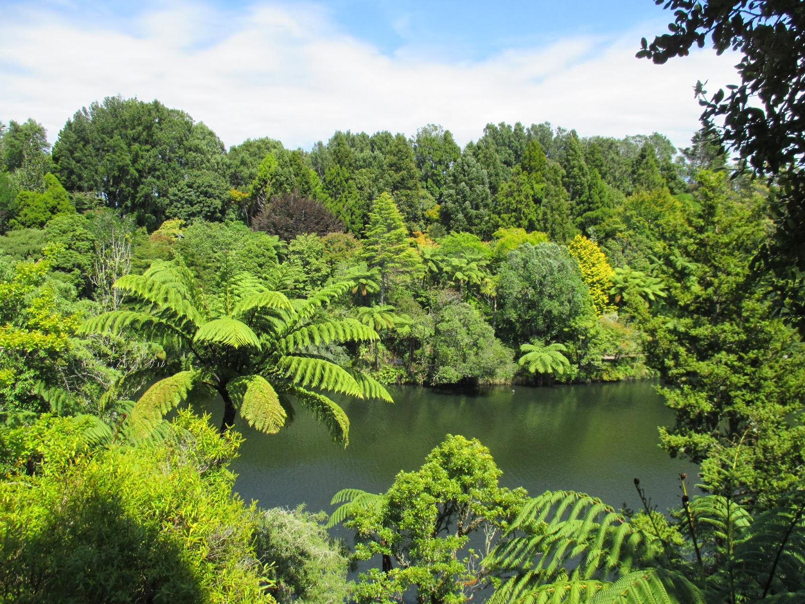
Pukekura Park in New Plymouth
Returning from our walking tour of New Plymouth we found the festival in full swing with an enthusiastic reggae band entertaining the crowds. Looming over New Plymouth is Mount Taranaki from which the wider region gets its name. Its a picture postcard mountain and another active volcano...so where better to camp for the night?!

We drove to Dawsons Falls road end about 1000 metres above sea leve, high on the side of the mountain where a Department of Conservation car park provided a free spot to stay as well as superb and ever changing views of the summit of Mount Taranaki. We had time to squeeze in a walk along a loop track to see Dawson Falls and quite a lot of the surrounding forest with trees draped in mosses creating an almost fairy tale atmosphere.

Dawsons Falls


Sunset - Mount Taranaki

As night fell we started to see the stars and the absence of lights from other people, houses or buildings meant the night sky was truly ablaze with star light when it became properly dark.

The next morning we set off heading south down the Surf Coast highway. This part of New Zealand is known for its surfing beaches and big waves. We eventually left the region amused by the signs at the side of the road. The first said "you are now leaving Taranaki", 250 meters later another sign said "why?" Stopping briefly in Whanganui where we saw a steam riverboat setting off and some more attractive art deco era buildings we maintained a steady southerly direction.


Scenes of Whanganui
Our next destination was a stopover en route to the south of the North Island and we found a campsite at Foxton. Foxton was a sleepy little one street town but remarkably had a full size replica Dutch windmill! There was no obvious reason for this...it didnt appear the town had been founded by Dutch settlers...so we left, bemused and none the wiser, for our campsite just outside the town, again near to a beach.


A little exploration revealed we were close to another river that opened out onto a long beach but reached by walking through extensive sand dunes. Our decision to take a late afternoon stroll to the beach led to a longer walk as we plotted a way through the dunes. Mrs B. was convinced we'd get lost and never be seen again!


We were now close to Wellington but had time to squeeze a couple more days and see somewhere new before we visted the capital city and said goodbye to the North Island. I'd read the small village of Martinborough was a good place to visit being both a pretty colonial village and the epicentre of another small wine region famed for producing some of the best pinot noir in New Zealand. There were supposed to be 20 wineries within 2 miles of the village centre. Sat nav was set to take us there and off we went....

Wednesday, 12 February 2014

"The breath of my mountain is my heart"

The title of this blog entry is taken from a Maori inscription displayed in stone in Whakapapa village. The great mountains of Tongariro have spiritual significance for the Maori people..but the area is also a World Heritage site, recognised as not just a place of great natural beauty but also one of cultural significance. 

I had wanted to walk in these mountains for a number of years, inspired by our eldest daughter, Helen. A few years ago she visited New Zealand and completed what is considered the finest day walk in the country and one of the top 10 in the world -the Tongariro Alpine Crossing. The following Christmas she presented me with a framed photograph of one part of the walk - a view of the Emerald Lakes. It hung on my office wall and during some challenging times at work would offer a glimpse of a future..one that at times seemed quite distant! 

So here I was...about to fulfil a long held ambition...and walk the Tongariro Crossing myself.

A few facts about the Tongariro Crossing. It is 19.4 kilometres long, one way, involves steep ascents and descents and crosses through a currently active volcanic area. All the guidebooks stress a need to be physically fit, that the going can be tough and to allow between 6-8 hours to complete it, not including stops.

Fortunately I felt pretty fit and Mrs B. agreed some relaxation time would be good... so was happy to wave me off at the start. As it's a one way walk I'd booked a shuttle bus to get to the start point and return me (hopefully) at the end of the walk. I'd also undetaken some strict dietary preparation the evening before with a meal of beans on toast and a glass of red wine!

It was 7.30 am when I started, early morning mist hung in the valleys, there was a slight chill in the air but the promise of a fine day. The first few kilometres involved a gentle climb in the Mangatepopo valley alongside the stream of the same name. Climbing higher brings you close to old lava flows from past eruptions of Mount Ngauruhoe which towers above. It looked ominous cloaked in early morning cloud and its alter ego as Mount Doom in the Lord of the Rings films seemed well deserved. The route is well waymarked and periodically markers tell you how far youve walked. The 1 km marker wasnt overly encouraging!
1 down...18.4 to go....
The top of the first stage reaches an area called Soda Springs..and had taken an hour. I was making good time but made a toilet stop.There are a couple of 'drop pit' toilets..not the cleanest I've used..but I've been to a few festivals...and in any event these are the last ones for about 8 miles. There are no trees to hide behind on the Tongariro Crossing! 

The first significant climb was lung bursting. Steep and unrelenting terrain gave ample time to pause, catch a breath and take in the lava flows of the past 2000 years including some from a major eruption in 1870 and ash deposits from 1975.  It was with some relief when the ground levelled out and a vast crater bowl opened up ahead of me. By this time the sun was beating down...and I was glad I'd got plenty of water.


The view back across the South Crater
The views of Mount Ngauruhoe and the other worldly scenery of the South Crater were reward for the first climb.  A long tramp across the South Crater brought the start of the steepest climb. A 340 metre steep ascent was hard going but I felt a sense of exhilaration at reaching the ridge and the highest point of the walk at 1886 metres (6100 feet) especially as more stunning views of Mount Tongariro, Mount Ngauruhoe and ridges of black volcanic rock with red oxide opened up from this high vantage point. 


The next section of the walk involved a rocky ridge walk (quite narrow in places) and then a steep descent to the Emerald Lakes on very loose volcanic scree. This was the view that had inspired me. You sometimes wonder if an experience you've anticipated is going to live up to your expectations...and I can confidently say that the view of the Emerald Lakes from above, with very visible eruptions of steam behind them, more than exceeded my expectations. 


This view is a show stopper..and I stopped to take plenty of photos. I was about half way so knew that there was plenty more tramping (the NZ term for hiking) to do. I carried on walking across the Red Crater...


The view back across the Red Crater
....arriving at the Blue Lake at about the right time for a picnic lunch. Fuelled by cheese and Vegemite sandwiches (made by Mrs B.) and compelled to get going by a hoard of voracious insects I moved on. It was mostly going to be downhill from here..and the steady descent started to tell on my legs. There was however still plenty to see. The volcanic landscape gave way to to Apline grasses and small flowers. On the shoulder of the mountain a continuous plume of steam acted as a reminder this was still a very active volvanoe zone...and a few warning notices urged caution!


The breath of the mountain.


This part of the mountain last erupted in 2012. Thousands of pieces of rock were ejected and the Ketatahi Hut was hit. This must be at least a mile away. Its been closed to walkers ever since but still offers toilets...there was a bit of a queue for these after 8 miles or so! 

The last stretch after Ketetahi Hut is 6.4 kilometres..but feels longer. The relentless descent took its toll on my calf muscles and for the first time in the day I felt a few twinges. The last couple of kilometres drop through green forest but with evidence of further volcanic activity. A stream bed was damaged by lahar (mud flows) as recently as September 2013. No wonder there are more signs encouraging you not to linger. At long last I turned a corner and reached the end. Although fatigued I felt a real sense of achievement but also a sense of humility that I'd been able to see and feel the breath of the mountain. 

When the shuttle bus dropped me back at the campsite Mrs B. served up a reviving cup of tea. After a hot shower, cold beer and plate of pasta it was time to sleep. I expected aching muscles the next morning and to be emitting a succession of 'old man' noises. To my amazement (and Mrs B's) I felt as fit as a fiddle. The mountains had been kind to me!